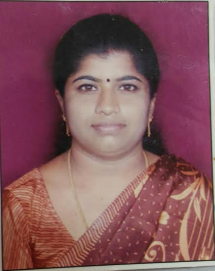
|
Name
|
Dr. K. GAJALAKSHMI
|

|
|
Designation
|
ASSISTANT PROFESSOR
|
|
Qualification
|
M.E, PhD
|
|
Experience
|
Teaching 13
Industrial 1
Research 6
|
|
Project Guided
|
Number of UG projects guided: 10
Number of PG projects guided: 02
|
|
Area of Interest
|
Remote sensing & GIS, Water resources
|
|
Date of Joining RVCE
|
04-08-2014
|
|
Email
|
gajalakshmik@rvce.edu.in
|
|
|
Publications:
|
|
|
|
National Conference : 2
International Conference : 4
International Journal:7
|
|
List of National Conference publications
|
- K.Gajalakshmi, Dr. Anantharama.V “Comparative analysis of drainage maps extracted from conventional approaches and Open Source DEMs: A case study in Southpenna watershed” National Conference on Geospatial Information and Technologies Advancement (GITA-2K15), held at Shri Madhwa Vadiraja Institute of Technology & Management, Bantakal, Udupi, India on October, 2015.
-
K.Gajalakshmi (2008), Developing a software module for automatic generation of DEM from aerial photographs, in the National conference on frontline areas of civil engineering, Organized by Dept., of Civil Engineering, VLBJCET Kovaipudur, Coimbatore.
-
K.Gajalakshmi, Gurusangamesh Y.Bagewadi “Identifying the location for Water Harvesting Structures - Using GIS techniques” National Conference on Recent Advances in Civil Engineering and Architecture for Sustainable Development” Jointly Organized by Department of Civil /CTM/ARCH –18th & 19th February, 2016
|
|
List of International Conference publications
|
- K.Gajalakshmi, Dr. Anantharama.V (2017) “Hydrogeomorphology Based Land-Use Planning For Sustainable Development Of Hard Rock Terrain Region Of Karnataka” 4th International conference on Earth science engineering by Andalas University, Padang Indonesia – 29th to 31st August.
- K.Gajalakshmi, Dr. Anantharama.V (2016) “Geospatial approach for Landuse plan in Southpenna Watershed” International conference on Geospatial Technologies for Urban, Forest & Climate change – Pathway to Sustainable Development organized by UGIT, Bangalore University – 28th and 29th November.
- K.Gajalakshmi, Dr. Anantharama.V “Morphometric analysis using GIS Techniques – A case study on Southpennar Watershed, Karnataka, India”, International conference on sustainable Energy and Built Environment, organized by ASCE and VIT University, Vellore, Tamil Nadu, ISBN:978-81-923320-6-2, pp: 816-822, March 2015.
-
K.Gajalakshmi(2015), Morphometric analysis using GIS techniques – A case study on Southpennar watershed, Karnataka, India, in an International conference on Sustainable Energy and Build Environment, organized by Department of Civil Engineering, VIT, Vellore, Tamil Nadu.
|
|
List of International Journal publications
-
K.Gajalakshmi, Dr. Anantharama.V (2017) “Evaluation of Water Quality for Irrigation Purpose in Sitanadi Basin, Udupi District, Karnataka” Journal of Remote sensing and GIS ISSN: 2230-7990 (Online), ISSN: 2321-421X (Print) Volume 8, Issue 1
-
K.Gajalakshmi, Dr. Anantharama.V (2017) “Hydrogeomorphology Based Land-Use Planning For Sustainable Development Of Hard Rock Terrain Region Of Karnataka” International journal of Civil Engineering & Technology (IJCIET) Volume 8, Issue 10, October 2017, pp. 698-705, ISSN Print:0976-6308 and ISSN Online:0976-6316; Journal Impact Factor(2016):9.7820 ; Thomson Reuters Researcher ID: B-7378-2016.
-
Dr. Anantharama V& K.Gajalakshmi Evaluation of Water Quality for Irrigation purpose in Sitanadi basin, Udupi District, Karnataka. Journal of Remote sensing and GIS(JoRSG) International ISSN( Online): 2230-7990, ISSN(print): 2321-7887 .
- Gajalakshmi K, Dr. Anantharama V “Micro watershed delineation and codification in Chikballapur district using GIS techniques” Journal of Remote sensing and GIS, Vol 7, Issue 1, Page:75-80
- K.Gajalakshmi, Dr. Anantharama.V “Comparative study of Cartosat-DEM and SRTM-DEM on Elevation data and Terrain Elements”, published in International Journal on Advanced Remote Sensing and GIS ISSN 2320-0243, Issue1, Volume4, pp:1361-1366, Nov 2015
-
Dr. Anantharama.V K.Gajalakshmi, “Prioritization of Micro/Mini Watersheds and Identification of Locations to Construct Rainwater Harvesting Structures using Morphometric Parameters and Geoinformatics” Journal of Remote sensing and GIS ISSN: 2230-7990(online), ISSN: 2321-421X(print) Volume 7, Issue 2
|
|
Interaction with Outside World:
Reviewer for the below listed International Journals and Conferences:
-
STM Journals: Journal of Remote sensing and GIS
-
Inder science Journals : Journal of Advance Remote sensing
|
|
Membership of Professional Societies / Institutes:
-
Membership in INDIAN SOCIETY OF REMOTE SENSING
|
|
Awards:
Received BEST PAPER Award for “Hydrogeomorphology Based Land-Use Planning For Sustainable Development Of Hard Rock Terrain Region Of Karnataka” from ANDALAS UNIVERSITY, Padang INDONESIA.
|
![]()

